
The Phelps County commissioners may apply for a grant to build a north outer road near Interstate 44 that would partially restore an old section of Route 66 near Rolla, Missouri, according to The Leader Journal newspaper in St. James, Missouri.
The new section of road would run between U.S. 63 and Missouri Highway V. The board would apply for $452,000 through the Missouri Department of Economic Development’s Community Development Block Grant program. Phelps County would give $131,000 and the City of Rolla another $37,500. If the county gets the grant, it would take about 21 months to build the road.
A key excerpt from the story:
Commissioners have stated that a new north outer road would improve driver safety, alleviate traffic through residential neighborhoods in the Northwye area, reduce heavy truck traffic on county roads, open the area for development, improve the appearance of the area and restore the original historic Route 66 path.
Currently, a north outer road starts at Highway V and turns into County Road 2020. From there, travelers can access Highway 63 via County Road 2000.
A preliminary drawing created by Hargis shows that the new outer road would run parallel to I-44 from where the state maintenance ends west of Route V to the east end of County Road 2000.
It turns out that the new road does not restore the original Route 66 in that part of the county. I asked Jerry McClanahan, a Route 66 researcher and author of the “Route 66: EZ66 Guide for Travelers” guidebook to check into it. In short, he found the county’s proposed new road would restore a late 1940s or 1950s section of Route 66, not the original alignment.
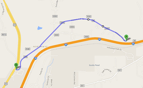
The original section of Route 66 between U.S. 63 and Highway V follows what now is County Road 2020 (see Google Maps screen capture above). That section remains accessible today, and is marked as Historic U.S. 66 locally.
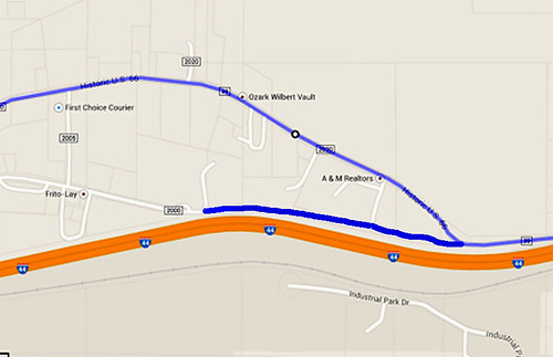
The proposed north outer road, McClanahan says, would reconnect a dead end of County Road 2000, which is the updated alignment of Route 66, circa 1950 (see screen shot of Google Maps above). That’s about 2,000 feet of new road. But the real part of that remains buried under I-44.
McClanahan sent me documentation from original maps from those eras to back his assertions.
So the county board thought it was doing a good deed for Route 66 travelers. It turns out it was still good — just not as good as they apparently thought it was.
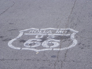
(Image of a section of Route 66 in Rolla, Missouri, by Dustin Holmes via Flickr)
Actually, Ron…the section being replaced is more likely to be a circa 1930s realignment. The revised topo map I sent you was dated 1950…but the actual road was rerouted earlier (and still in use in 1950). Hey…its complicated stuff!