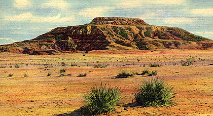
Tucumcari Mountain, near Tucumcari, N.M., has long been one of the Mother Road’s most-recognized natural landmarks.
It was first mentioned in journals in the 1700s, and can be seen for miles from Route 66 and Interstate 40. For the weary traveler looking forward to a night’s sleep in Tucumcari, the sight of the mountain has served as a beacon. And the legend of how the mountain got its name is entertaining, if highly unlikely.
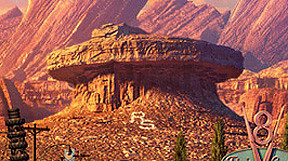
Tucumcari Mountain even served as an inspiration for the mesa seen in the fictional Route 66 town of Radiator Springs in the movie “Cars” — right down to the “RS” letters on the side of the mountain instead of the real-life “T.”
Tucumcari Mountain sports a distinctive look because it looks like two mesas that were plopped on top of each other. According to MountainZone.com, Tucumcari Mountain stands at 4,951 feet above sea level, nearly 1,000 feet above the city for which it’s named.
I’ve been somewhat surprised to see no previous online journals from others who have hiked the mountain. Tucumcari Mountain is dotted with numerous radio and cell-phone towers, which means maintenance trucks have to get up there some way.
It turns out it’s not that easy. First, Tucumcari Mountain is on private property, so there’s always the danger of being caught trespassing. Second, the base of the mountain is 1 1/2 miles down a primitive dirt road, even before you start climbing. Third, hiking the mountain itself can be strenuous, especially when dealing with iffy footing, no water facilities and New Mexico’s intense sun.
Without delving too much into the details, I made arrangements with a local resident, who contacted one of Tucumcari Mountain’s owners to give us permission to hike the mountain, and gave us a ride in his pickup truck to the mountain’s base, sparing us a lot of additional walking.
Emily and I decided to hike up Tucumcari Mountain to see what’s there. We also wanted to share our experience with Route 66ers who would be unable to do this themselves.
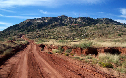
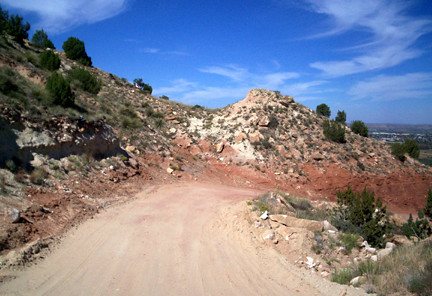
The trail going up the mountain is a primitive dirt and gravel road only wide enough for one truck. The image above conveys a gentle grade, but that would change quickly.
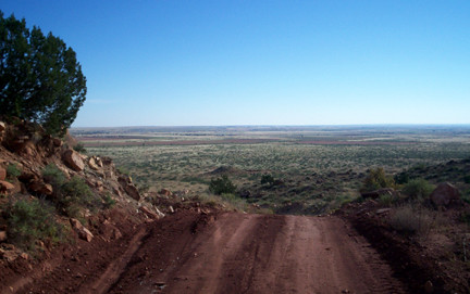
Hiking up the mountain to its first “level” requires a few switchbacks.
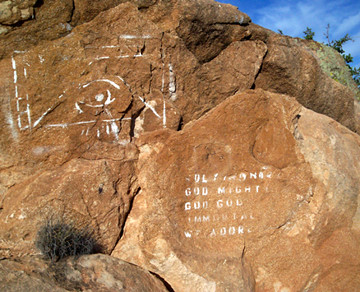
We obviously weren’t the first sightseers. This chiseled graffiti looks quite old.
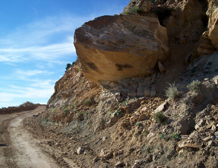
When hiking up Tucumcari Mountain, there is another hazard that becomes apparent — erosion. Here’s a huge boulder that eventually will tumble onto the trail.
On our way down, we encountered a few rocks that had come loose and tumbled onto the trail less than an hour before. One of the rocks was the size of a basketball.

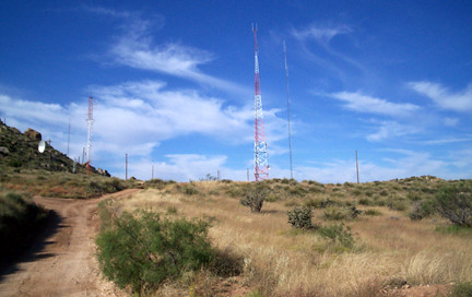
On the first level of the mountain are several radio and cell towers.
Nearby is the big “T,” for Tucumcari, halfway up the mountainside. The rocks and boulders that form the letter are whitewashed each year by the local high-schoolers.
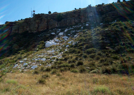
In fact, the mops and buckets that were used for the whitewashing were left near a big bush. I guess they’ll use them again next year.
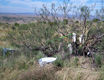
And here’s what the rest of Tucumcari Mountain looks like, from near the first level.
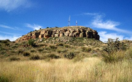
Hiking to Tucumcari Mountain’s uppermost peak was particularly strenuous. The footing on the trail was looser, the grade steeper. We were really sucking air going up the last leg.
There’s a gate to keep unauthorized vehicles from going to the top, but it can be easily walked around.
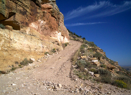
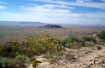
At a switchback on the south side of the mountain, you get this spectacular view of Bulldog Mesa in the foreground and the massive Mesa Redonda in the distance.
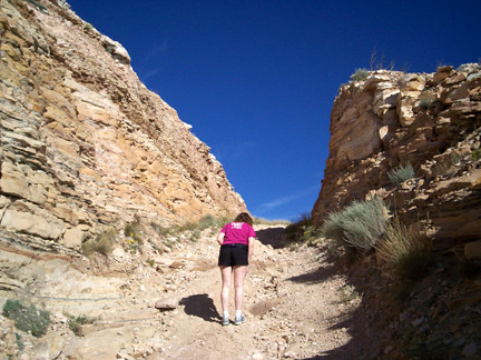
The hike to the top is the toughest. This gap between the rocks appears natural, but it may have been partly blasted through, too.
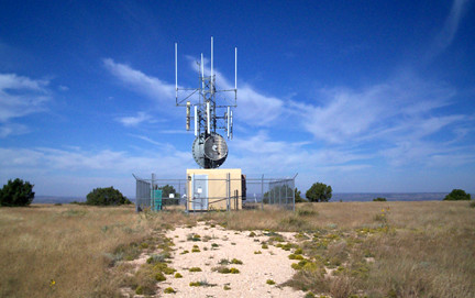
The peak of Tucumcari Mountain is about 125 yards wide and flat, just like a mesa. And, of course, there are radio and cell-phone towers, too.

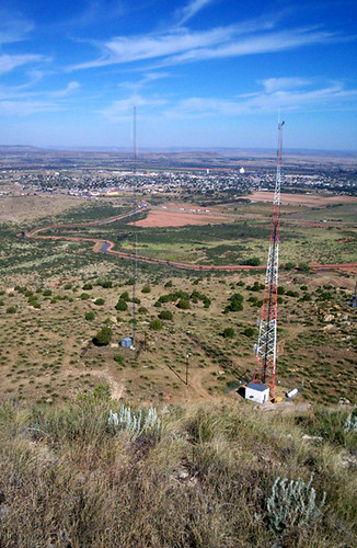
And here’s a view from the top of Tucumcari Mountain, overlooking Tucumcari.
And here’s a 360-degree video from the peak.
One of the most enjoyable parts of the hike was observing the foliage and insects. You wouldn’t think such a rocky environment would support much. But we saw lots of colorful cacti, scrub brush and succulents — many of them in bloom after recent monsoon rains.
Many of the insects were colorful as well. We saw a shiny-blue fly on a flower, and plenty of locusts with bright orange or vivid blue wings. Fortunately, we didn’t see (or hear) any rattlesnakes.
(More photos from Tucumcari Mountain can be seen here.)


Hi, Ron and Emily, Enjoyed your hike so much. Thanks for the pictures. You know I love Tucumcari! Your 66 pal Jane
What a great story! I really enjoyed “hiking” with you. Thanks for sharing.
Great post! Thanks for sharing your hike. I almost feel wided just looking at the pictures
winded
Thanks, Ron and Emily, for the spectacular photos!
Great pictures! By the way, the top of the mountain is called the “biscuit.” I enjoy hiking the area pretty regularly. Our church has been granted a radio station permit and hope to place another antenna on the mountain.
Ron and Emily, I read in many places that on top of the mountain there are seashells from when NM was underwater. Did you notice any seashells or remnants of any kind?
No, we haven’t seen seashells on the mountain. That doesn’t mean they don’t exist, however.
Thanks, Ron. The article I read years ago implied that they were all over the place, which I was skeptical of. And since I cannot drive up there, and am turning 63 this year, I thought it best to read about these things rather than clamber up the mountain myself Very interesting article about it, thanks very much, good reading for those who wondered about the mountain, besides just seeing it off in the distance.
Well, I suppose you could find seashells if you were actually looking for them. I do recall seeing a few in the parking lot of the Blue Swallow Motel in town, and it’s almost certain the gravel came from a local source.
But, to be honest, we were looking more closely at other details on the mountain, such as the foliage and man-made features.
Thanks again, Ron. As I mentioned, this is really interesting, as few of us ever got to go on top of that mountain, while seeing it many many times en route thru NM west or east, and seeing it as a definite landmark that no one could possibly miss, but in my case always wondering if one could drive up there easily and with permission, and your entries tell me otherwise, so just to see the photos and hear your descriptions, is very interesting, as a longtime “fan” of that area and its geography. So I signed up to subscribe to this so as to see other people’s viewpoints etc. Thanks.
I appreciate the compliments. One of the reasons my wife and I hiked up Tucumcari Mountain was to satisfy our own curiosity. The other was to do it on behalf of others who cannot, for whatever reason.
Hard to imagine that that entire area was once underwater. Same when you drive through Kansas and other plains states, the fact that there are shark’s teeth and fossils galore is interesting in itself.
Great article and pictures. My family lived in Tucumcari in the late 40’s/early 50’s and my brothers hiked the mountain many times.
My sisters and I were not allowed to go there…too dangerous!
To quote Bob Hope: “Thanks for the memories!”
Hello Ron,
I stumbled across this post of yours while googling Tucumcari Mountain, and I am so grateful I did because you’re the only one I can seem to find that has this much first-hand information on it! I’m doing some research on the area for a story of mine and I have no idea what it’s like, as I’m from a completely different part of the country. I was wondering if you could tell me just some minor things about it that you may know- like how many people come to visit the mountain every year? How difficult is it to get permission to hike there? Does a company own it, or a family, or just one person? Are they strict about permissions and/or enforce the “no trespassing” heavily? Is the road leading up to it on private property as well? And do you by any chance no any stories/information on the rock graffiti there? I personally think it’s beautiful! Sorry if that’s a lot of questions, haha! I’m just really trying to find out more information on how it will fit into my story. Thank you so much for your time!!!
I do not know how many climb it each year. No more than a few hundred, I suspect, most of them locals. Tucumcari Mountain has about eight owners, depending on what part of it you are standing on. I made arrangements to hike the mountain through a local motel owner. I am not aware of there being a huge problem hiking the mountain because I have met residents who have done it with no problems. But when I did it, I thought it was better to be safe than sorry. I have no ideas on the origins of the graffiti but I did not ask any locals either.
I really enjoyed this story as I recently rode my dirt bike up to the top 2 weeks ago while my family and I were staying in Tucumcari on our way to Pagosa Springs, CO, a yearly family vacation. My 2 1/2 year old son’s favorite movie is Cars, coincidently which we watched multiple times in the portable dvd player along the way. I always knew the inspriation from the movie had to come from this town, right down to the T in Tucumcari and the cool midcentury motels preserved in time, epecially the Blue Swallow, I have never seen a motel with private garages attached to the rooms like in the movie Cars when they are at the Wagon Wheel Inn. I have always wanted to summit the top of this thing to see what was up there, luckily I had my dirt bike with me in my truck. I cheated and trespassed around the gate thinking if I got caught I could always charm my way out in admiration for the scenery, I think I passed one of the owners on a 4 wheeler on the way up there and he politely waved as I rode past. I had a great time riding up there, the last leg, as you know is incredibly steep, I had a tough enough time on a dirt bike designed for this kind of terrain, I can’t imagine a utility truck trying to get up there. It really is a beautiful sight and I never realized how high and how vast the scenery is up there. We plan to stay in Tucumcari for years to come and I plan on making the ride up there every time. Perhaps I’ll get permission next time.
thanks for sharing this i enoyed reading and seeing what i miss about tucumcari!
Looking forward to more comments here.
Has the mountain been mined? There seemed to be several out pours of materials, as seen from I-40.
I found this blog when I Googled Tucumcari Mountain. In June, 1969, my family stopped at a convenience store for lunch meat and bread on our way to LA. I was the oldest of seven children with two adults in a station wagon towing a pop-up trailer, having just graduated from high school. Picture a mob sitting eating sandwiches and chips and drinking Kool-Aide. I remember sitting on a curbing sandwich in hand staring at the mountain just off of I-40 and wondering about it. With a brisk wind and low humidity, I was struck by the fact that the soft bread was as dry as toast before I could finish my sandwich. Almost 46 years later, it’s etched in my mind as if it was yesterday. Using Google earth and maps to look at Tucumcari Mountain, it looks as if you could drive close to the top. Google Street View turns left off the road as one “drives” toward the mountain from I-40, where the road striping ends and the rougher road begins. I was disappointed that the Google car turned off.
I am really appreciative of your hiking the mountain and not only providing a vivid description, but actual pictures and video of the hike and the view of the countryside and the mountain’s namesake town.
I recently retired and yearn to travel out west to explore the national and state parks and monuments. Coming west from Louisville, picking up old Route 66 seems to certainly be a great way to start my exploration. I look forward to reading more on route66news.com. Thanks so much for your entry and description of my lunchtime object of interest from almost a half century ago.
Thanks for the comment, Robert. Yours is the reason I hiked up the mountain — so that I could share the experience with others who could not do it.
I climbed Tucumcari mountain in 1959, straight up the side, in flats and a straight skirt.
David Stratton
September 27, 2016 6:13 pm I
I grew up in Tucumcari in the 1930s and 1940s and climbed Tucumcari Mountain many times, once at night. Also, I found an arrowhead on top of the second section, or the “Biscuit,” as we called it. As a young boy, when the FAA beacon light swept a broad yellow beam from horizon to horizon to direct planes, I liked to image what it would be like to climb aboard that beam and ride it throughout its journey. Well,anyway, you get the picture–Tucumcari Mountain is part of me, something like the New England boy who admired the mountain’s face until his own came to resemble it. To make a long, long story shorter, I am a retired history professor at Washington State University in Pullman, and am writing a book on Tucumcari–not the usual genre of an old coot recalling the adventures of his youth, but a serious scholarly account, using Tucumcari as a case study of the influence of transportation development, mainly railroads and Route 66, on a western town. I expect to have it in print in the next year or so, with the title, “Tucumcari Tonite: Railroads and Route 66 66 in the Life of a Western Town.” You might want to keep an eye out for it–and, of course, buy it. Oh yes, this account of hiking up the mountain is great, especially the photos of the road/trail gouged in its side by town boosters to attract the tourist trade–a real travesty!
Thank you for the great comment, David. I’m looking forward to your book.
Will watch for your book David. An old friend form the 30’s and 40′ Juanita Graham Brooks I thought the girls trip great!
Hi there Ron,
My wife and I are traveling to Tucumcari again in late March this year and were wondering whom to get a hold of, as we would very much like to hike up Tucumcari Mountain ourselves!
Access to Tucumcari Mountain has been tightened considerably since it changed hands a few years ago. I don’t know of anyone now who will give permission.