The City of Springfield, Mo., on Tuesday showed off its revitalization plan for College Street that incorporates Route 66 history and nostalgia into its design, reported the Springfield News-Leader.
The plan for College Street, which carried one of Route 66’s alignments through town, includes public and private funds for the effort.
According to the newspaper:
Leaning heavily on local residents for direction, the city has crafted a plan for a mixed-use district that will allow “very flexible development” while reflecting the area’s connection to the original Mother Road, said Vern Morgan, the city planner who directed the effort. […]
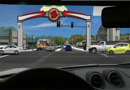
Unique zoning rules and tax incentives are planned, while Route 66 signage, a roadside park — even a recreation of the Red’s Giant Hamburg sign — are among the physical improvements the city hopes will lure private investors. […]
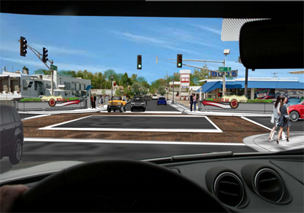
Working with City Utilities, the city recently applied for a $10 million federal grant that would help pay for a new bus transfer station near College and Main Avenue, as well as street and sidewalk improvements on College all the way west to Kansas. […]
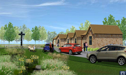
Rognstad said the city plans to pay for the basic infrastructure at the roadside park, including a drive and parking, but hopes to work with Community Foundation of the Ozarks to solicit donations for other features, such as the Red’s Giant Hamburg sign. […]
Representatives of Hy-Vee grocery store got the ball rolling Tuesday by presenting the city with a check for $1,000. The money, meant to help pay for the replica Red’s sign, was raised during a Route 66-themed spring fundraiser.
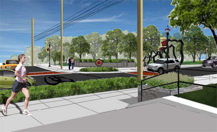
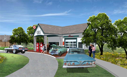
Here are artist’s renderings of the proposed streetscaping and parks from the city:

You can read the entire College Street Corridor plan in this 23-page document.
If the city is going through all the effort to do this they should seriously plan to burying the power lines. The really ruin the look (see artist’s sketch).
Looks very nice. I especially like the roadside park. What would be the actual “uses” for the gas station and motor court? Are they closed buildings, just used for decoration/photo ops to enjoy while using the picnic facilities? Are they open as businesses of some sort (gift shop, restaurant)?
In the planning meetings that went on for over a year before this plan was unveiled, several uses were discussed. One was to have them available for businesses, yes. But another was to us them as meeting spaces or recreation spaces, possibly with a user fee or rental fee involved. I don’t think the final use has been decided. Last I knew, the City is still exploring options for their uses.